On October 31, 2026, the National Oceanic and Atmospheric Administration’s Climate Prediction Center updated its monthly outlook maps for November. The fresh data provides a major update on which U.S. states face heightened odds for heavy snow and high-impact winter weather in the coming month.
Which U.S. States Face the Heaviest Snow and Winter Weather Conditions in November?
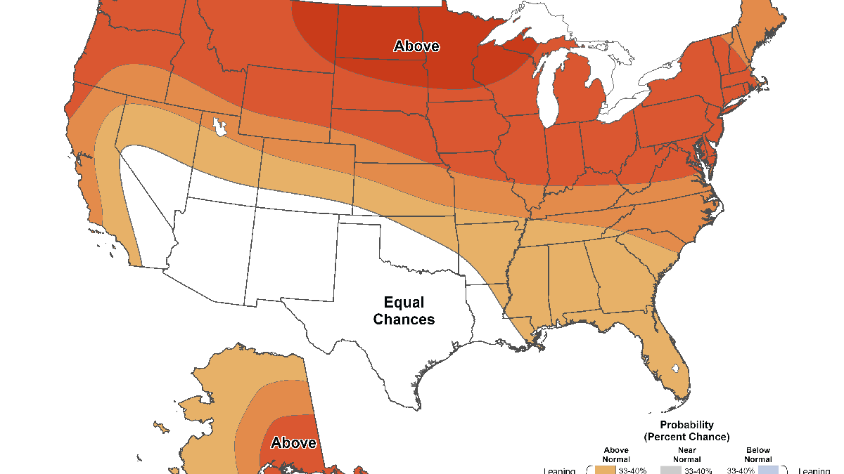
Photo credit: National Oceanic and Atmospheric Administration/NOAA.gov
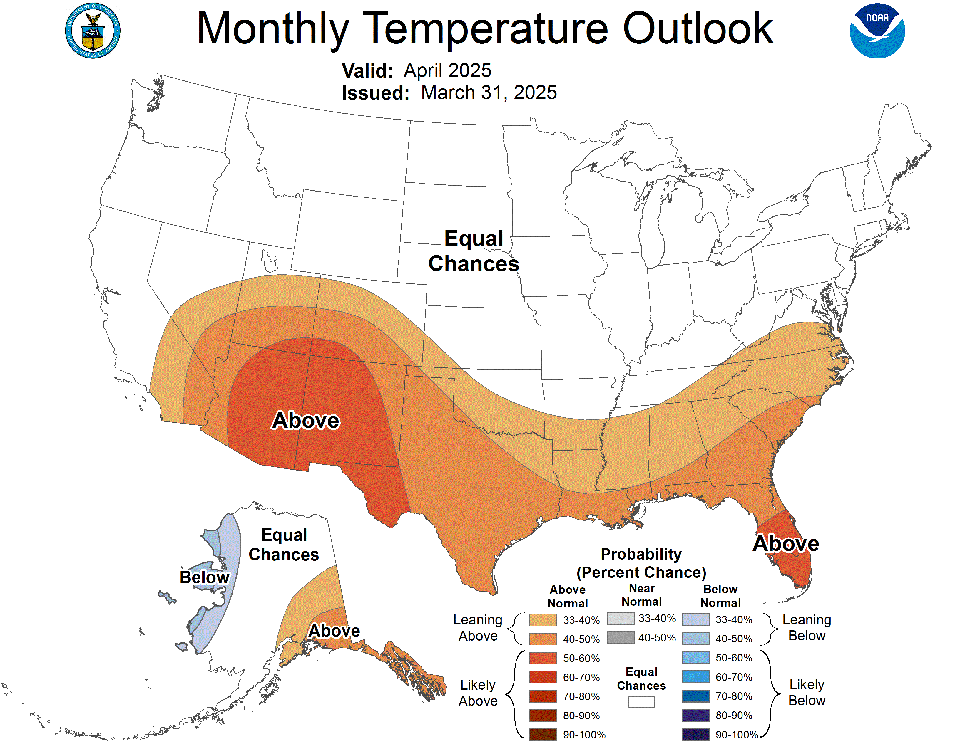
NOAA has just updated its monthly outlook maps for November. As reports on weather conditions for the coming month have been forecasting for weeks now, the map points to a high likelihood that most American states will face above-normal temperatures in November 2026. That may make some observers assume that heavy snow will not be a major factor in the coming weeks, but that certainly isn’t true.
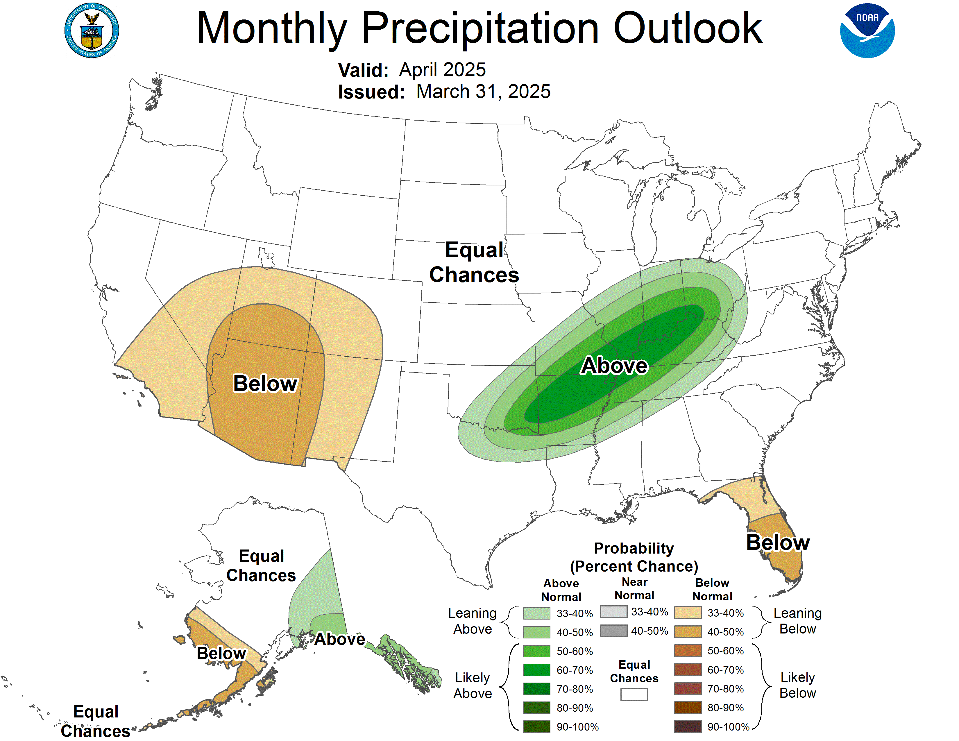
As the November Temperature Outlook map shows, a significant portion of the country still has an equal chance of seeing above-, below-, or normal temperatures according to NOAA. That includes large areas in Southeast California, South Nevada, South Utah, South Colorado, Southeast Arkansas, East Louisiana, most of Oklahoma, and all of Arizona, New Mexico, and Texas. Simultaneously, all of those regions fall under areas in the November Precipitation Outlook that have a 33% to 90% chance of experiencing above-average precipitation.
With high probabilities of wetter-than-average conditions and equal chances of above-normal, normal, or below-normal temperatures, the parts of those states in the white equal-chance zone could face heavier snow than normal in November. That is especially true in high-altitude zones across Arizona, New Mexico, Utah, Colorado, Nevada, and Eastern California, where snowpack can accumulate quickly.
In addition to those places that are included in the equal chances area on the Monthly Temperature Outlook, there are other areas of the United States that will still almost certainly see heavy snow. That holds true even if it is warmer there than average. Those areas include several northern and high-latitude regions where temperatures are normally so cold that even when it is warmer than typical, precipitation will still freeze. Obvious examples of that include the snow belt, the Northern Rockies, the Cascade Range of Washington and Oregon, and the Alaska Range.
November Is Going to Be Very Wet Across Most of America
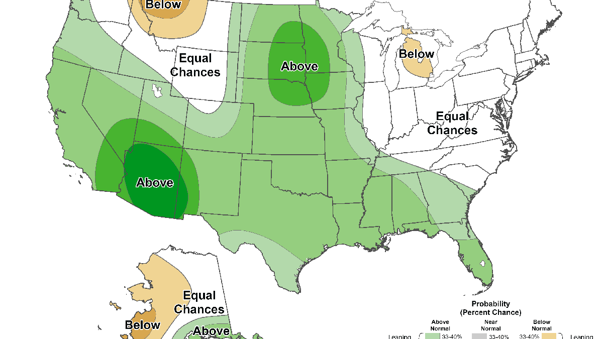
Photo credit: National Oceanic and Atmospheric Administration/NOAA.gov
Similar to how the Temperature Outlook map is dominated by above-normal areas, the same holds true for the Precipitation Outlook map. In warmer states like Florida, Texas, and Louisiana, NOAA’s forecast indicates that heavy rains are likely approaching, while other areas face a mix of rain and snow. On the other hand, there are areas in the Northeast and Northwest that are facing either equal chances or even below-normal levels of precipitation this month.
Next: Winter Storm Travel Kit: Safety Experts Share the Must-Have Items Drivers Often Forget